Thank you to everyone who has called, emailed and texted in regards to the ever-increasing level of the Mississippi River.
Living downtown in Harbor Town, we are very close to the river, and so we are on watch.
This is the river today. Depth is difficult to understand in these photos, but keep your eye on the line of trees furthest to the right in this photo. Can you see that the water and debris line is past it?

I think I've made up the word "debris line," but it is so fitting with this flood because the huge amount of water is carrying large pieces of debris, such as this entire tree.

Here's another look from the same spot as the first photo. See the debris line past the furthest right tree?
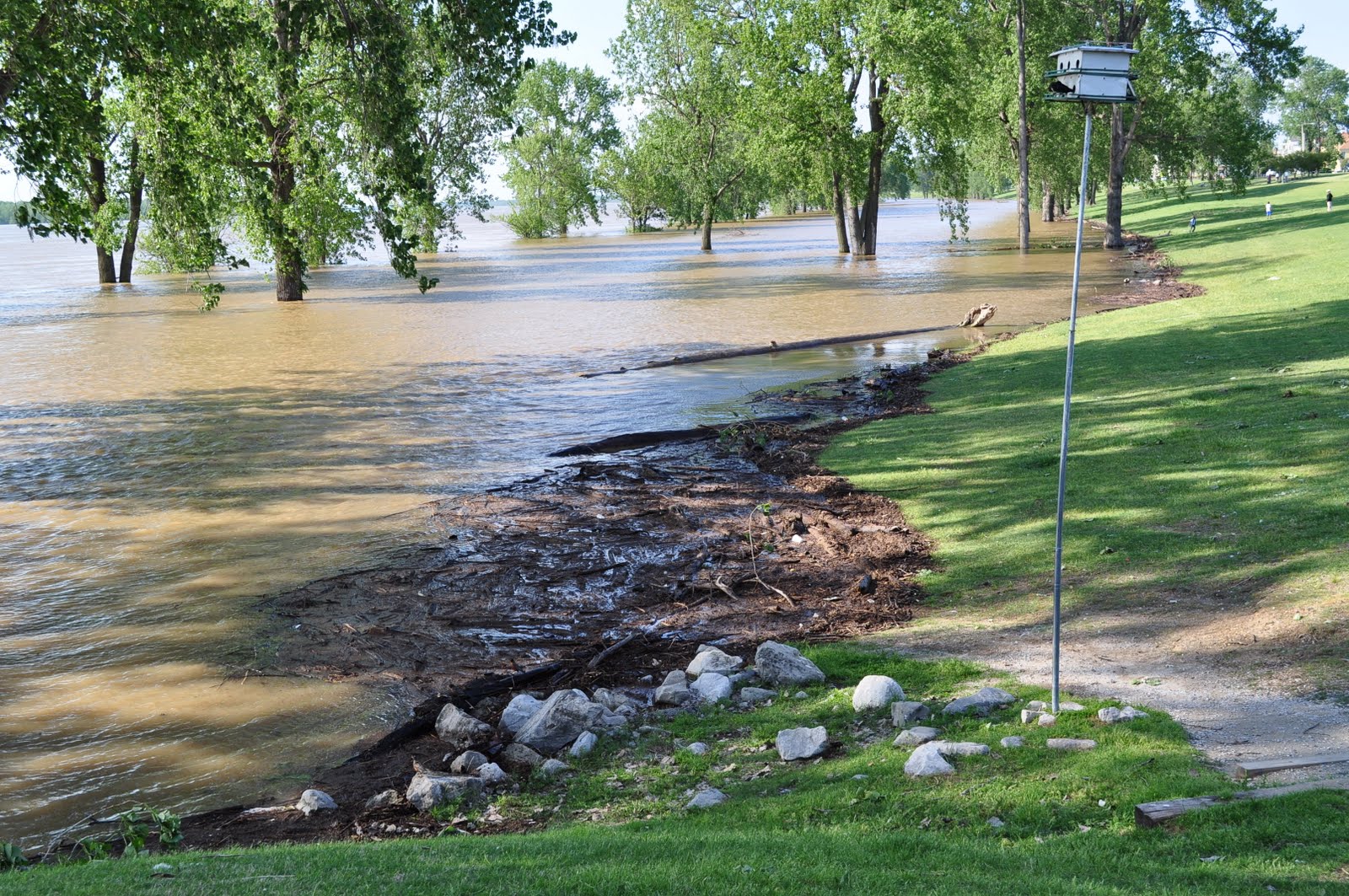
This is still today, and this is further down the park, away from the I40 bridge and closer to where the Wolf River empties into the river.

Between the grass area, which is the just below the street level, and the tree line is usually a grassy park complete with a walking trail.

These are huge trees, and you can see here that you can't see the bark. Keep in mind that the foot of this tree should be on dry land.

This was the river level yesterday, and this photo was taken around the same time of day from the very same spot as the first photo. It mostly looks the same, unless you look at the tree furthest to the right. Can you tell that there is no water or debris around the foot of the tree?

These next photos were taken March 13, 2011, when the river flooded. This photo was taken standing in the lower part of the park on the walking trail. You can easily see the two tree lines. The trees on the left are on the same tree line as the marker tree from the first photos.

This is from the same time period, when the water increased to the second tree line. Note that you can still see the barks of the trees.

Compare all of that to this photo. It's the park the way it should be if the river were at a normal level. You can easily see the width of the park in between the tree lines.

To give some scale, this photo was taken earlier in the year, while standing in the lower park on the walking trail. That tree now is flooded up to the branches.

Now to the numbers. I take photos and Chris makes spreadsheets. It's the whole yin and yang thing.
Here's his sheet. Note that the date are historical dates, and the river projection for May 10, 2011, was based on the projections as of April 26. Also, the "feet" from house is in elevation. Not like six walking feet from our house. You may not have thought that....I might have.
(I know these graphics bleed the column on the blog. It was the only way to read them.)
(I know these graphics bleed the column on the blog. It was the only way to read them.)

Here is a list of flood heights, and what that would mean in relation to our neighborhood and area.

So that's the story. We will be fine, but we do expect some flooding to impact the area. For example, we have two entrances to the island. One is the main one down the river walk, and the other is what I call the "ugly end".
This is the ugly end today. It's difficult to see from this photo, but there is water covering the road. The reflection of the trees make it difficult to tell that it's water.

But don't worry, friends. We've got a canoe, if needed, and Grace knows her place in it.

No comments:
Post a Comment